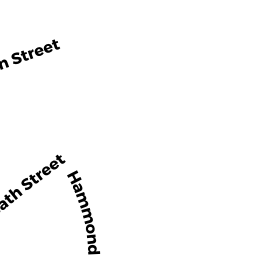
687 HAMMOND ST
Owner Information
LEUNG ET AL RICHARD C
80 ALGONQUIN RD
CHESTNUT HILL, MA 02467


Property Details
687 HAMMOND ST is classified as a Two-Family Residential (Decker).
The primary structure on this property was built in 1960. There is 2352ft2 of residential/living space within this property. This property is listed as having 10 rooms. There are 2 units within this property.
687 HAMMOND ST is valued at 1076300. The land is valued at 567400 and the structures are valued at 508900.
This property is in Zone T-6. Confirm with local Zoning Board authorities to ensure there are no overlays or other easements on this property.
The most recent deed for 687 HAMMOND ST is recorded at the local registrar in Book 7192, Page 558. 687 HAMMOND ST was last sold on 1986-08-14 for 15000.
Assessment data from fiscal year 2021.
Flood Data
According to the FEMA National Flood Hazard Layer, this property does not appear to be in a flood zone. It may also be in an area not yet reviewed. Nonetheless, confirm this information prior to taking any action.
To view the flood hazards around this property, create a FEMA "Firmette" Map of the area around 687 HAMMOND ST.
Broadband Internet Providers
| Provider | Type | Bandwidth (mbps) | |
|---|---|---|---|
| Verizon New England Inc. | DSL | 10 | 1 |
| Viasat Inc | Satellite | 100 | 3 |
| Crown Castle Fiber | Fiber | 0 | 0 |
| GCI Communication Corp. | Satellite | 0 | 0 |
| HughesNet | Satellite | 25 | 3 |
| Comcast | Cable | 1000 | 35 |
| VSAT Systems, LLC. | Satellite | 2 | 1 |
| RCN | Cable | 500 | 20 |
| RCN | Cable | 1000 | 20 |
Broadband service provider data from December 2020.
Adjacent Properties
- 584 HEATH ST
Church, Mosque, Synagogue, Temple, etc... owned by ROMAN CATHOLIC ARCHBISHOP - 679 A HAMMOND ST
Undevelopable Residential Land owned by ROURKE JR JAMES C - 689 691 HAMMOND ST 2
Residential Condominium owned by ELBERT ALEC M & VERONIKA - 689 691 HAMMOND ST 1
Residential Condominium owned by CHADBOURNE MARK E - 681 683 HAMMOND ST 683B
Residential Condominium owned by WHITMORE ERIKA L - 681 683 HAMMOND ST 681A
Residential Condominium owned by BENSON CANDYCE - 681 683 HAMMOND ST 681B
Residential Condominium owned by NURME R DAVID & LISA B - 681 683 HAMMOND ST 683A
Residential Condominium owned by GATES TRS PETER R & DEBORAH M